What's new
  • Visit Rebornbuddy
  • Visit Panda Profiles
  • Visit LLamamMagic
  • Visit Resources
  • Visit Downloads
  • Visit Portal

Update on the new maps

Aevitas

Well-Known Member
Joined
Mar 2, 2010
Messages
2,307
Reaction score
36
We've been working hard on implementing a better navigation system to fix the amount of crashes into walls, water silos, and so on and so forth, and we've come quite a long way!

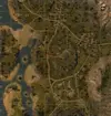
Here's a sneak preview of what the maps look like to TankLeader in the new version, where it assumes blue is terrain it can drive on.

Himmelsdorf

HdxkO.jpg


Dragon Ridge

CkTAB.jpg


Airfield

o8ETD.png


This hopefully, once and for all eliminates the bot trying stupid things on different game modes, and will allow it to navigate by itself properly. It also opens up the door for user-made profiles.

Long story short; we have a lot of cool stuff coming up. Stay tuned! :)

 
Hopefully it's just because the ground plane is below the water plane, because there's a whole lot of areas in Airfield where most of the battles take place that is grayed out due to it being slightly inundated.
 
Hopefully it's just because the ground plane is below the water plane, because there's a whole lot of areas in Airfield where most of the battles take place that is grayed out due to it being slightly inundated.

Yeah we are tweaking the water. Currently, actual navigable water is shown as non-navigable terrain, so yeah. This is very much a work in progress, and we'll look to improve that before actually implementing it. By the looks of things, this will actually be in the current TL.
 
Very very good work :cool: Did you think about not only making the map as a boolean grid (drivable, not drivable), but giving every area unit allowed directions instead? So the bot would know that it can drive down a hill but not upwards. Just an idea. Maybe this is something for tank leader 3 :D
 
Very very good work :cool: Did you think about not only making the map as a boolean grid (drivable, not drivable), but giving every area unit allowed directions instead? So the bot would know that it can drive down a hill but not upwards. Just an idea. Maybe this is something for tank leader 3 :D

We could technically add those afterwards yeah, but we don't want to. Reason being is the bot can't judge if it's going to demolish the tracks or several parts when driving off a cliff like a human could. I'd rather have the bot play it safe and not smash the tracks when driving off a cliff. :P

Anyway here's an update of mines: imgur: the simple image sharer

Though it looks good to me (the navigable water between the mainland and the western isles), I'd like to ask you guys if you think it looks alright or it needs some more adjusting.
 
Here's the map image as reference.

572px-Hills.webp

Looks good. Maybe it goes a little bit over the map border at the very west.
 
I'm absolutely ok with the new map system. I really look forward to it.
 
Indeed, hope to test it out soon, but hopefully after you guys fix the too many tanks in the garage causes a disconnect issue first.
 
Here's the map image as reference.

View attachment 77092

Looks good. Maybe it goes a little bit over the map border at the very west.

Map borders shouldn't really be an issue as the bot will never be told to go there anyway, and going all around the edges of the map is never the optimal route from A to B.
 
repair maps bugs
could you please correct the TL
that it could be used as long as the TL 2 become
 
Last edited:
We're currently running some tests using the new navigation, and I can tell you guys that you're in for a treat. Seriously. It just did Dragon Ridge, flawlessly.
 
Aevitas ...sounds pretty good ... but well, we always get information without any estimate. may you at least give us a rough one?
 
Aevitas ...sounds pretty good ... but well, we always get information without any estimate. may you at least give us a rough one?

We're most likely going to release a beta with this new pathing in tomorrow, so that should be short enough for everyone. :)
 
i cant wait, today is the implementation of the new pathing...cheers :D
 
We could technically add those afterwards yeah, but we don't want to. Reason being is the bot can't judge if it's going to demolish the tracks or several parts when driving off a cliff like a human could. I'd rather have the bot play it safe and not smash the tracks when driving off a cliff. :P

Anyway here's an update of mines: imgur: the simple image sharer

Though it looks good to me (the navigable water between the mainland and the western isles), I'd like to ask you guys if you think it looks alright or it needs some more adjusting.

Hoping to test it tomorrow!

Aevitas, can you explain how is the route calculated with the new drive/nodrive terrain? For example the central hill in mines, it has grey borders around the blue "driveable" terrain. So how it's going to reach it? Or the hangar in himmelsdorf, where its blue inside, but roof is grey, despite the fact you can enter it. Or the dragon ridge hills, they have blue area inside, surrounded with grey borders, so whats the point in having driveable terrain where it cant be accessed anyways?

Should there be just one big blue area with no isolated pieces? Like if you imagine the "Fill" function in paint, where it will color everything it has access to, ignoring isolated areas...
 
Will the new system be used to find a way around dynamic obstacles like tanks and wrecks? Please say yes. The old stuck algorithm is really a pain.
 
Back
Top